
Bhengkek:20170805 Bolivia 1195 crop Sucre sRGB (26204170499).jpg
Bhengkek sokkla (3.417 × 2.563 piksel, okoran bhengkek: 1,47 MB, lambân MIME: image/jpeg)
.jpg)
Rèngkessan
| Jhâjhârbâ'ân |
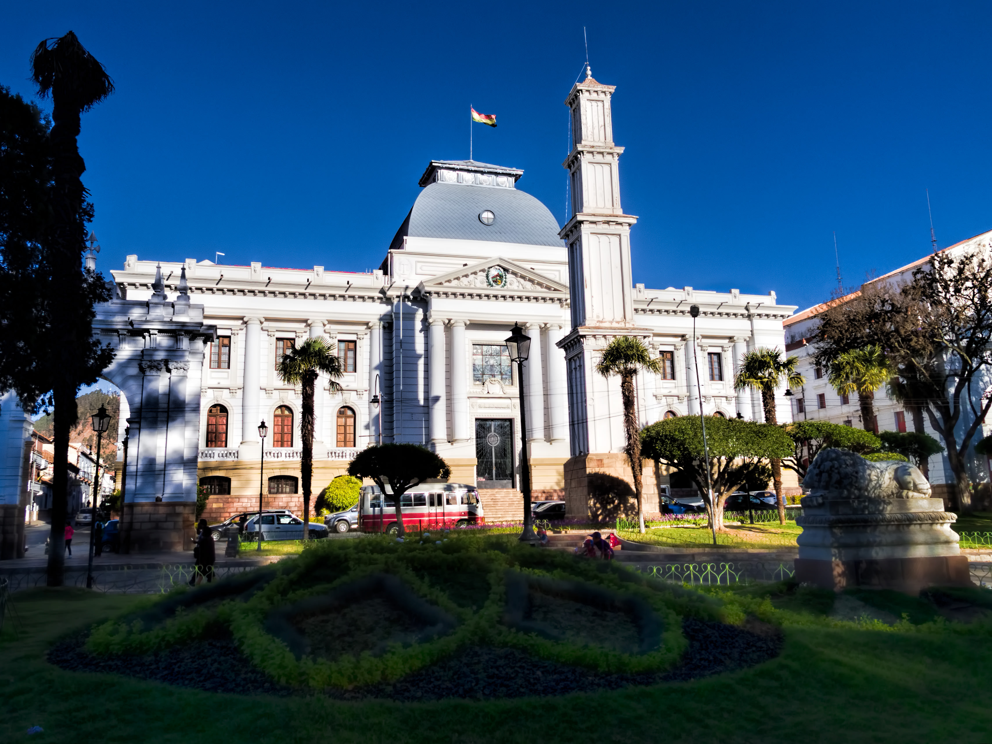
The Supreme Court building, inaugurated in 1945, faces Bolívar Park (Parque Bolívar). Sucre is known as “The White City” because most of the buildings are painted white—and usually have a roof of terracotta tiles. Sucre (elev. 2,810m/9,214ft) was founded by the Spanish in 1538 as Ciudad de la Plata de la Nueva Toledo (Silver City of New Toledo). It became the judicial, religious, and cultural center of the region. Bolivia achieved independence from Spain on 6 August 1825, the last country in Latin America to do so. In 1839 the city was declared the capital of Bolivia and renamed in honor of Antonio José de Sucre (1795-1830), a leader of the fight for independence who was a close friend of Simón Bolívar and served as the second president of Bolivia from the end of 1825 to 1828. (The administrative capital of Bolivia shifted to La Paz in 1898.) The Historic City of Sucre was declared a UNESCO World Heritage Site in 1991. On Google Earth: Supreme Court 19° 2'36.16"S, 65°15'46.58"W |
| Tangghâl | |
| Sombher | 20170805_Bolivia_1195 crop Sucre sRGB |
| Pangghâbây | Dan Lundberg |
| Lokasi kamera | | Lihat gambar ini dan gambar di sekitarnya di: OpenStreetMap |
|---|
.jpg¶ms=-19.042600_N_-065.263381_E_globe:Earth_type:camera_source:Flickr_&language=mad)
Lèlla
- Bâ'na ollè:
- Abâgi – nyalèn bân nyalambheraghi polè matèri rèya ḍâlem robâ otabâ format apa bhâi;
- mon ngobâ'â – ngarang, ngobâ, bân aghâbây toronan ḍâri matèri rèya
- Aḍhâsaraghi katantowan arèya:
- atribusi – Bâ'nâ kodhu aberri' pangakowan sè teppa', aberri' pranala ḍâ' lèlla-lèlla, bân aberri' tao mon bâḍâ obâ'ân. Bâ'na ngennèng alampa'aghi lèbât cara sè èkaterrowè bâ'na, tapè rèya ta' neptepaghi mon orèng sè aberri' lèlla makoko otabâ pangangghuyânna bâ'na.
- AbâgiMaghâs – Mon bâ'na ngobâ otabâ aghâbây toronan ḍâri karjâ rèya, bâ'na kodhu manyalambher dhurrun bâ'na è bâbâ lèlla sè paḍâ ènga' lèlla ḍâ' karjâ sokkla.
| This image was originally posted to Flickr by Dan Lundberg at https://flickr.com/photos/9508280@N07/26204170499 (archive). It was reviewed on 2 Novèmber 2017 by FlickreviewR 2 and was confirmed to be licensed under the terms of the cc-by-sa-2.0. |
Riwayât bhengkek
Klik è tangghâl/bâkto mon nèngghuwâ bhengkek arèya ka bâjâ kasebbhut.
| Tangghâl/Bâkto | Miniatur | Ḍimènsi | Pangangghuy | Komèntar | |
|---|---|---|---|---|---|
| jângkènè | 2 Novèmber 2017 22.56 | | 3.417 × 2.563 (1,47 MB) | Ser Amantio di Nicolao | Transferred from Flickr via Flickr2Commons |
Pangangghuyân bhengkek
Kaca arèya ngangghuy bhengkek rèya:
Pangangghuyân bhengkek global
Wiki sè laèn ngangghuy bhengkek arèya:
- Pangangghuyân ka ar.wikipedia.org
- Pangangghuyân ka csb.wikipedia.org
- Pangangghuyân ka en.wikipedia.org
- Pangangghuyân ka es.wikipedia.org
- Pangangghuyân ka mdf.wikipedia.org
.jpg)